The Isar Cycle Path Through Munich
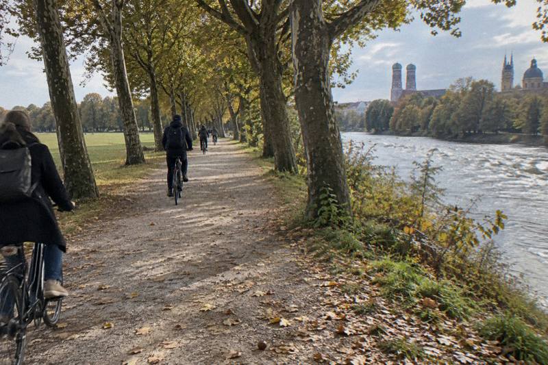
The Isar is the line most Munich bike routes follow: gravel banks, bridges, the Flaucher meadows and the Deutsches Museum island, all stitched together by a car-free path.
Short answer
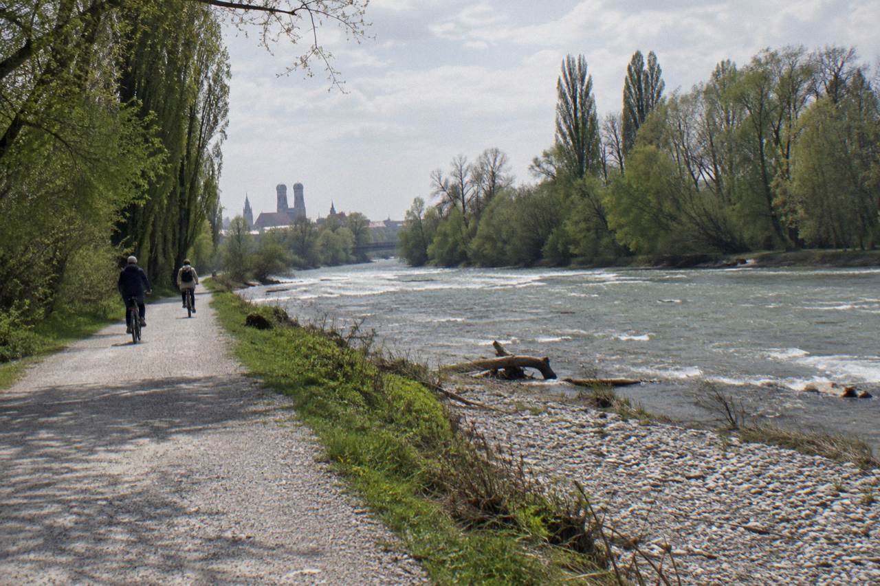
The Isar cycle path is a signed, largely car-free route along the river through Munich, part of a 299 km route from Scharnitz in Tyrol to the Danube near Deggendorf. An official city loop from Marienplatz covers about 15 km in about 2 hours, and guided tours use the banks as their spine.
The Isar decides how Munich rides. Nearly every classic guided route in the city, from short Old Town loops to full-day e-bike rides toward the Alps, spends at least part of its time on the gravel and asphalt along this river, because the banks form a car-free corridor that runs from the southern edge of the city straight through the centre. Riders get the English Garden on one side, the Deutsches Museum island in the middle, and the Flaucher meadows to the south, all connected without a single road crossing if the route is chosen well.
What Is The Isar Cycle Path In Munich?
It is the Munich section of a signed long-distance route that follows the Isar for 299 km from Scharnitz in Tyrol to the river's confluence with the Danube near Deggendorf. The Munich to Landshut stretch runs about 77 km and is described as largely flat and intersection-free, which is why so many city tours use the banks as their backbone rather than the road network.
The river itself is not a canal or a single engineered channel through Munich. It splits around islands, runs through the English Garden, and is flanked by steep gravel terraces on the high banks. The path network on both sides is part of the Münchner Radlnetz, the city's signed route system of 1,200 km in total, built from 14 radial routes starting at Marienplatz plus inner and outer ring routes and green corridors, including the Isar route itself. That structure matters for visitors: if you lose the river, a signed radial route will usually bring you back to the centre.
Cycling has a 21 percent share of daily trips in Munich, the highest among German large cities, and the Isar corridors are a big reason why. On a warm weekend the banks carry commuters, families, road cyclists and tour groups in a steady two-way stream. The surface shifts between asphalt on the busier stretches and compacted gravel on the riverside terraces, so a city bike or trekking bike handles it comfortably.
| Route fact | Figure | What it means for riders |
|---|---|---|
| Full Isar cycle route | 299 km, Scharnitz to the Danube near Deggendorf | A multi-day touring route, not a city loop |
| Munich to Landshut stretch | About 77 km | Largely flat and intersection-free per route data |
| Signed Munich cycle network | 1,200 km, including the Isar corridor | Signposted radials lead back to Marienplatz |
| Official city Isar loop from Marienplatz | About 15 km, about 2 hours | A realistic half-day self-guided ride |
| Cycling share of Munich daily trips | 21 percent | Highest of German large cities, busy banks |

Where Does The Path Enter And Leave The City?
The signed long-distance route reaches Munich from the south, having descended from the Alpine foothills, and leaves the city heading north toward Freising and Landshut. The Munich to Landshut section of about 77 km is described as largely flat and intersection-free, making it the natural direction for a day ride out of the city with a train return.
Inside the city the useful mental model is a ladder, not a single line. The river runs roughly south to north, and a series of bridges lets riders switch banks wherever a stretch is closed, crowded or less pleasant. The city's own suggested tour published by the tourist office starts at Marienplatz, follows the Isar downstream, rides through the English Garden to Aumeister at its northern end, and returns, a loop of about 15 km at a relaxed pace of about 2 hours. That shape, centre to river to park and back, is also the shape of most guided city rides.
South of the centre the corridor continues past the Flaucher and on toward the southern city limits, where the valley opens toward the Alps. This southern stretch is what the full-day e-bike rides use: the 5-hour Isar valley e-bike tour is built on forests, valleys and Alpine panoramas, and the river path is its connective tissue.
Getting back from the north or south with tired legs is where the trains come in. Bikes need the MVV bike day ticket in the S-Bahn, U-Bahn and approved regional trains, valid across zones M to 12 from validation until 6 a.m. the next day, with U-Bahn blocked on weekdays 6 to 9 and 16 to 18 and the S-Bahn blocked weekdays 6 to 9. Our guide to bikes on trains and S-Bahn in Munich covers the timing rules in full, including the school-holiday exceptions that lift the afternoon block.
How Far Can You Ride Along The Isar In One Day?
A relaxed rider covers the official 15 km city loop in about 2 hours. Heading north, the Munich to Landshut stretch of about 77 km is largely flat, so a fit rider on a regular bike can reach Landshut in a day. Heading south toward the Alpine foothills, the terrain gains elevation, which is exactly why the guided full-day option in that direction is an e-bike ride of about 5 hours.
The choice of direction is really a choice of scenery. North of the city the valley is wide and the riding is flat riverside gravel and farm-track cycling, suited to a picnic day with a swim stop. South of the city the valley narrows, forests close in, and on clear days the Alps sit on the horizon; the Isar e-bike tour's listing leans on exactly that, promising forests, valleys and panoramic views of the Alps over its 5 hours.
Time budgeting also depends on stops. The 2-hour official loop assumes steady riding with brief pauses; add a beer garden stop at the Chinese Tower, a swim at a designated section, or an hour at the Deutsches Museum island, and the same 15 km becomes a half day. Guided rides bake the stops in: the classic guided city tours run 3 to 4 hours with a beer garden break, which is a comfortable pace for the same corridor plus the Old Town approach.
Which Bridges And Islands Mark The Route?
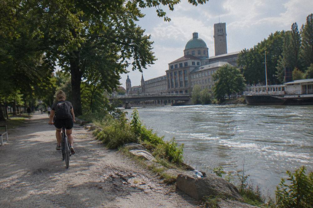
The two anchors most riders remember are the Deutsches Museum island, where the river splits around the museum in the middle of the city, and the Flaucher, the southern meadow and weir area where the gravel banks are widest. Between them, a ladder of bridges lets riders switch banks, and the English Garden begins where the northern banks open out into parkland.
The Deutsches Museum island is the structural centre of the Munich Isar. The museum occupies the island between two branches of the river, and the paths along both branches pass directly beneath it, so a rider coming down from the Old Town meets the river exactly here. It is the natural start or midpoint of any self-guided ride, and the museum itself, one of the world's largest science and technology museums, turns a ride break into a half-day visit if the weather turns.
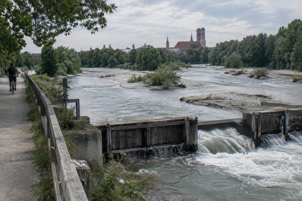
The Flaucher, south of the centre, is where the river landscape feels least urban. Gravel banks, back channels, shady trees and a weir define the area, and it is the swimming and sunbathing focus of the southern banks. The stone terraces of the high bank above give the section its profile.
Further north the river enters the English Garden, and the corridor changes character from urban river to designed park of 1789, with 78 km of paths shared between cyclists and joggers. The park's rules apply there rather than road rules: dogs must be leashed, barbecues and open fires are prohibited, and swimming in the Eisbach, the channel that runs through the park, is prohibited as life-threatening. Our English Garden by bike guide covers the park's paths, the Chinese Tower beer garden at the foot of the 25 m tower, and how tour routes thread through it.
Where Can You Legally Swim In The Isar?
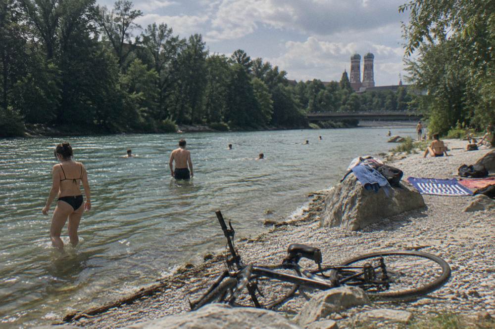
Swimming in the Isar is allowed only in seven designated sections, for example the stretch between Großhesseloher Brücke and the Braunauer Eisenbahnbrücke on both banks, with listed exceptions around weirs and bridges. Swimming is prohibited when the water level exceeds 1.20 m at the Munich measuring point, and it is always at the swimmer's own risk, as the river has no official EU bathing-water monitoring.
The designated-section rule catches out visitors who assume the whole river is fair game. The city publishes the seven sections with a map in the Isar app, and the exceptions matter: weirs and bridge surroundings are excluded even inside a designated stretch, and the Eisbach in the English Garden is off-limits entirely. Water temperature in a typical summer runs 14 to 22 C, with a maximum of 22.4 C recorded since 2011, so even on a 30 C afternoon the river feels bracing.
The level rule is the one that changes day to day. The Bavarian Flood Information Service gauge at the Munich measuring point drives the 1.20 m threshold, and after heavy rain in the Alps the Isar can rise quickly and carry a heavy sediment load. Riders planning a swim stop should check the gauge on the day rather than relying on yesterday's weather. Our post on whether you can still swim in the Eisbach separates the surf wave rules from the swimming rules, since the two are often confused.
For riders, the practical swim-stop advice is simple: build the stop into a designated section, lock the bike where you can see it, and keep shoes on the gravel. The gravel banks are kind to bare feet only in spots, and the current is stronger than it looks from above.
What Does The English Garden Add To The Isar Ride?
The English Garden is where the Isar corridor meets 78 km of park paths, and for most visitors it is the highlight of the ride: a 376-hectare park, open year-round with free entry, whose cycling and jogging network connects the city centre to Aumeister at the northern end without touching a road.
The park sits between the Eisbach channel and the Isar itself, and the official city loop runs through it on the way north. Three features define the ride. The Chinese Tower, a 25 m wooden structure from the 1789 design, anchors the middle of the park with a beer garden at its foot. The Eisbach surf wave sits at the southern edge near Haus der Kunst, where surfing is allowed again under an amended general decree of Lord Mayor Dominik Krause, with a mandatory self-releasing leash and a ban from 22:00, and riders should follow the posted signs. And the meadows in between carry the FKK designated zones at Schönfeldwiese and Schwabinger Bucht, which surprise visitors who do not know they exist.
Guided rides treat the park as the payoff for the road kilometres through the Old Town. A ride such as Munich: English Garden, Olympic Park and Nymphenburg Palace by Bike runs 3 hours and strings the park together with two more of the city's big green spaces, a format that suits riders who want variety over depth. The listing names no specific stops, so what the guide shows on a given day varies; check the booking page for the route description before booking.
Riders going alone should know the park's own rules, which sit on top of road rules: no barbecues or open fires, no camping, dogs on leads, and no unnecessary riding across meadows. On summer Sundays the central paths are dense with pedestrians, and the general rule of constant caution and mutual consideration from German traffic law is the working rule here too.
Should You Ride The Isar Alone Or Take A Guided Tour?
Riding alone suits confident cyclists who want the 15 km official loop at their own pace, since the corridor is signed, car-free and flat. A guided tour adds a bike (and a helmet on most listings), a guide who explains what you are passing, and a route that strings the river together with the Old Town and beer garden stops; guided options run from 2-hour private rides to the 5-hour e-bike tour.
The honest trade-off is freedom against context. The Isar banks are self-explanatory as landscape but not as history: the difference between a pleasant gravel ribbon and the story of how Munich rebuilt its river matters, and a licensed guide carries that. Cost-wise, a rental plus a day of self-guided riding comes in cheaper than any guided tour. For public options, the Munich bike rental prices and pickup guide covers the MyRadl share system, with classic bikes at EUR 1 per 30 minutes and a EUR 9 day tariff, while shop pricing is best checked on arrival. A deeper comparison of the two approaches is in rent a bike or take a guided tour in Munich.
| Guided format | Duration | Best for |
|---|---|---|
| Half-day classic city ride with local guide | 3 hours | First-time visitors wanting the river plus Old Town |
| City ride with beer garden break | 4 hours | Riders who want a long lunch stop on the route |
| Three-park ride (English Garden, Olympiapark, Nymphenburg) | 3 hours | Variety: river, park and palace in one loop |
| Private highlights ride with licensed guide | 2 hours | Tailored pace and questions |
| Full-day Isar valley e-bike ride | 5 hours | The southern valley and Alpine views without exhaustion |
Riders who enjoy a beer garden midpoint should look at the 4-hour Munich: Bike Tour with Beer Garden Break, which builds the stop into the route rather than leaving it to chance. Check availability if a guided lunch stop sounds like your kind of day.
One more honest note on guided rides: tour review pools on some of these options are small, and the Isar valley e-bike ride currently has 5 reviews, too few to support any rating claim. Treat the route descriptions as the decision basis and the reviews as colour, not proof.
What Does The Full-Day Isar Valley E‑Bike Ride Cover?
**The listing describes a 5-hour shared e-bike ride through the Isar valley, forests and valleys toward panoramic views of the Alps, making it the one ride here that turns the southern river corridor into a full day out. It is an e-bike ride, one of the electric bike options that let you cover more ground with less effort.
The direction is the point. Where the classic city rides use the Isar inside the ring, this one follows it out toward the Alpine foothills, trading museums and beer gardens for forest and horizon. The listing names no specific stops, and no kilometre total or elevation figure is stated, so riders should check the booking page for the route description, meeting details and what is included before booking. The river is the one corridor that works at every scale, from a 2-hour loop to a full day south.
E-bike choice suits this ride for two reasons. The southern valley gains elevation where the northern stretch does not, and 5 hours in the saddle is a different proposition with assistance. Riders who prefer a shorter assisted ride can look at the 4-hour Best of Munich Electric Bike Tour, which stays closer to the centre; our e-bike or regular bike for seeing Munich guide works through the decision in detail. Check availability for the valley ride if the Alpine version of the river is the one you want.
Riders who want a shorter, classic small-group format for the city end of the corridor can also consider Munich by Bike: Half-Day Tour with Local Guide, a 3-hour shared ride with a local guide, and check its availability for their dates.
When Is The Best Season For The Isar Path?
The path is rideable year-round, but the seasons differ sharply: July averages a high of about 24 to 25 C with long evenings, while January averages only about 2 to 4 C. May is the wettest month at roughly 92 to 108 mm of rain over 16 to 17 rain days, and winter riding depends on the city's winter service, which clears bike paths from 3 cm of snow.
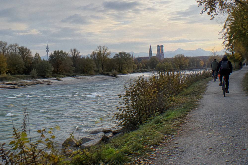
Summer is the season the river corridor was built for: swimming sections in use, the Eisbach wave busy, beer gardens open, and the path at its most crowded. The trade-off is density on the narrow central stretches, especially Sundays in the English Garden. Spring brings the May rainfall peak, so riders in April and May should plan around showers rather than against them. Autumn is the connoisseur's pick: the gravel banks are quieter, the water is still swimmable in the early weeks, and the Oktoberfest period, the 2026 edition ran 19 September to 4 October and drew about 7.4 million guests, puts enormous pressure on the city but leaves the river corridor comparatively calm.
Winter riding is more viable in Munich than in most cities because of the winter service policy, which runs 2:00 to 22:00 and clears all bike paths including bicycle streets once 3 cm of snow falls, with about 155 km of priority routes cleared within 2 hours. Cyclists have no winter tyre obligation, unlike cars, and studded tyres are permitted. If a signed bike path is not cleared, cyclists may ride on the road instead. Our Munich in winter on a bike guide covers lights, clothing and the legal bits, including the lighting rules from StVZO section 67 that apply once the days shorten.
How Do You Plan A Self-Guided Isar Ride?
Start at Marienplatz, follow the official 15 km loop down the Isar, through the English Garden to Aumeister and back, and budget about 2 hours of riding plus stops. Bring a lock for museum and beer garden stops, check the river gauge if you want to swim, and plan a train return if you extend north or south, remembering the MVV bike day ticket and its weekday blocked hours.
Bike choice matters less than riders fear. The corridor is flat, the gravel is compacted, and the city's share bikes handle it, though a day of share-bike fees at EUR 9 for a classic MyRadl adds up against a shop rental whose price you should check on arrival. E-bikes from the share system cost EUR 3 per 30 minutes or EUR 18 per day, worth it only for the southern climb. Helmets are not legally required for adults on standard bikes or pedelecs, though many operators supply one free.
Rules knowledge for the corridor is short. Ride at constant caution, keep right, ring the bell early around pedestrians, and dismount where signs ask. Children up to 8 must ride on the pavement, and up to 10 may. After dark, approved lighting front and rear is required. Our cycling rules for visitors in Munich guide covers the rest, including which signed paths are compulsory and how the bicycle streets, 103 of them totalling 47 km, give bikes priority at a 30 km/h cap.
| Planning item | What to do | Where the rule or figure comes from |
|---|---|---|
| Route | Marienplatz, Isar downstream, English Garden, Aumeister, return | Official tourist office loop, about 15 km, about 2 hours |
| Swim stop | Use one of seven designated sections, check the 1.20 m gauge rule | City swimming rules for the Isar |
| Train return | Buy the MVV bike day ticket, avoid U-Bahn weekday peak blocks | MVV carriage rules, zones M to 12 |
| Bike | Share bike, rental or tour bike all work; e-bike for the south | MyRadl tariffs and tour listing flags |
| Timing | Summer for swimming, autumn for quiet, winter possible with lights | Season data and city winter service policy |
The corridor rewards the unhurried. A rider who leaves at 10, swims at the Flaucher at noon, lunches at the Chinese Tower beer garden in the early afternoon and rolls back along the eastern bank by 4 has seen the river the way locals do, and no guided format beats that day for price. The guided formats beat it for context, for kids' patience, and for the southern valley, which is a different ride entirely.
Common Questions About The Isar Cycle Path
Isar River Munich
The Isar is Munich's central river, and its banks carry the city's most-used car-free cycling corridor, part of a 299 km signed route from Scharnitz to the Danube. The official city loop from Marienplatz covers about 15 km in about 2 hours along it.
Can You Cycle The Whole Isar Cycle Path In One Day?
No. The full route is 299 km and is a multi-day tour. The Munich to Landshut stretch of about 77 km is largely flat and rideable in a day by a fit rider, with a train return using the MVV or DB bike ticket rules.
Is The Isar Cycle Path In Munich Flat?
Inside the city and to the north, yes: the Munich to Landshut section is described as largely flat and intersection-free. South of the city the valley gains elevation toward the Alpine foothills, which is why the guided full-day ride in that direction is an e-bike tour.
Where Can You Swim In The Isar In Munich?
Only in seven designated sections, for example between Großhesseloher Brücke and the Braunauer Eisenbahnbrücke, and never when the Munich gauge exceeds 1.20 m. Swimming is always at your own risk, and the Eisbach in the English Garden is prohibited entirely.
Do Guided Munich Bike Tours Use The Isar Path?
Most do. The river corridor forms the spine of the classic city rides, which run 3 to 4 hours with beer garden stops, and the full-day e-bike option follows the valley south toward Alpine views over about 5 hours.
Is The Isar Path Rideable In Winter?
Yes. The city clears bike paths from 3 cm of snow, with about 155 km of priority routes cleared within 2 hours, and there is no winter tyre obligation for bikes. Approved lights front and rear are required after dark.